 info@kaziranga-national-park.com
 + 9212777225 / 9212553107
- Home/
- About Kaziranga /
- Location of Kaziranga
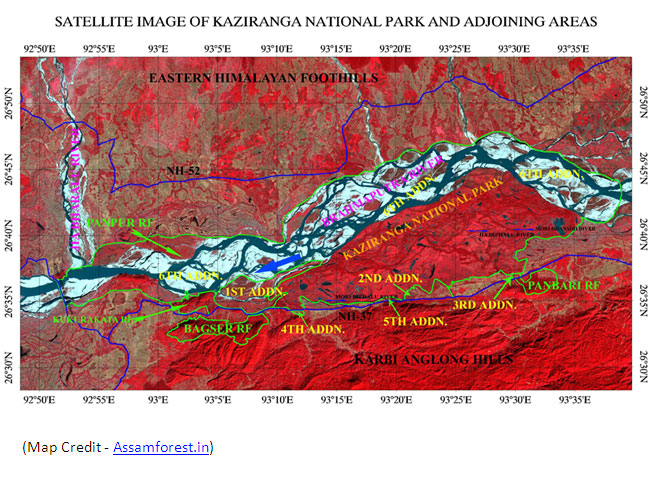
Location of Kaziranga National Park
Located in the Kaliabor and Bokakhat subdivisions of Nagaon and Golaghat districts in the state of Assam (India), Kaziranga National Park lies between latitude 26°30 N to 26°45 N and longitude 93°08 E to 93°36 E. It is around 40 kilometres long (approx. 25 miles) and 13 kilometres (approx. 8 miles) broad. The park is spread in 378.22 sq. km in which 51.14 km² has been lost to erosion by the Brahmaputra. Along with the present boundary of the park, 429 sq. km (166 sq miles) has been added and advised to separate the national park, so as to offer extensive habitat for growing population of wildlife or as a passageway for the safety of animals to Karbi Anglong Hills. The entire area of park is confined by the Brahmaputra River that forms the eastern & northern boundaries, and the Mora Diphlu that forges the southern boundary.
 Share
Share Home
Home Packages
 Book Now